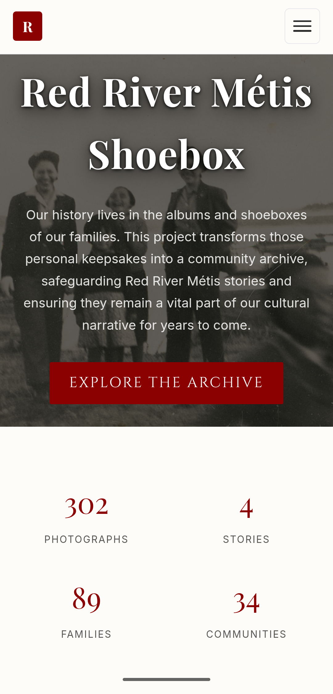
300+ photos were sitting in shoeboxes, slowly fading. I built a system to scan, catalog, and map them so the community can search by family, story, and location. The software was the easy part. Collecting the photos was not.
React
Leaflet
IndexedDB
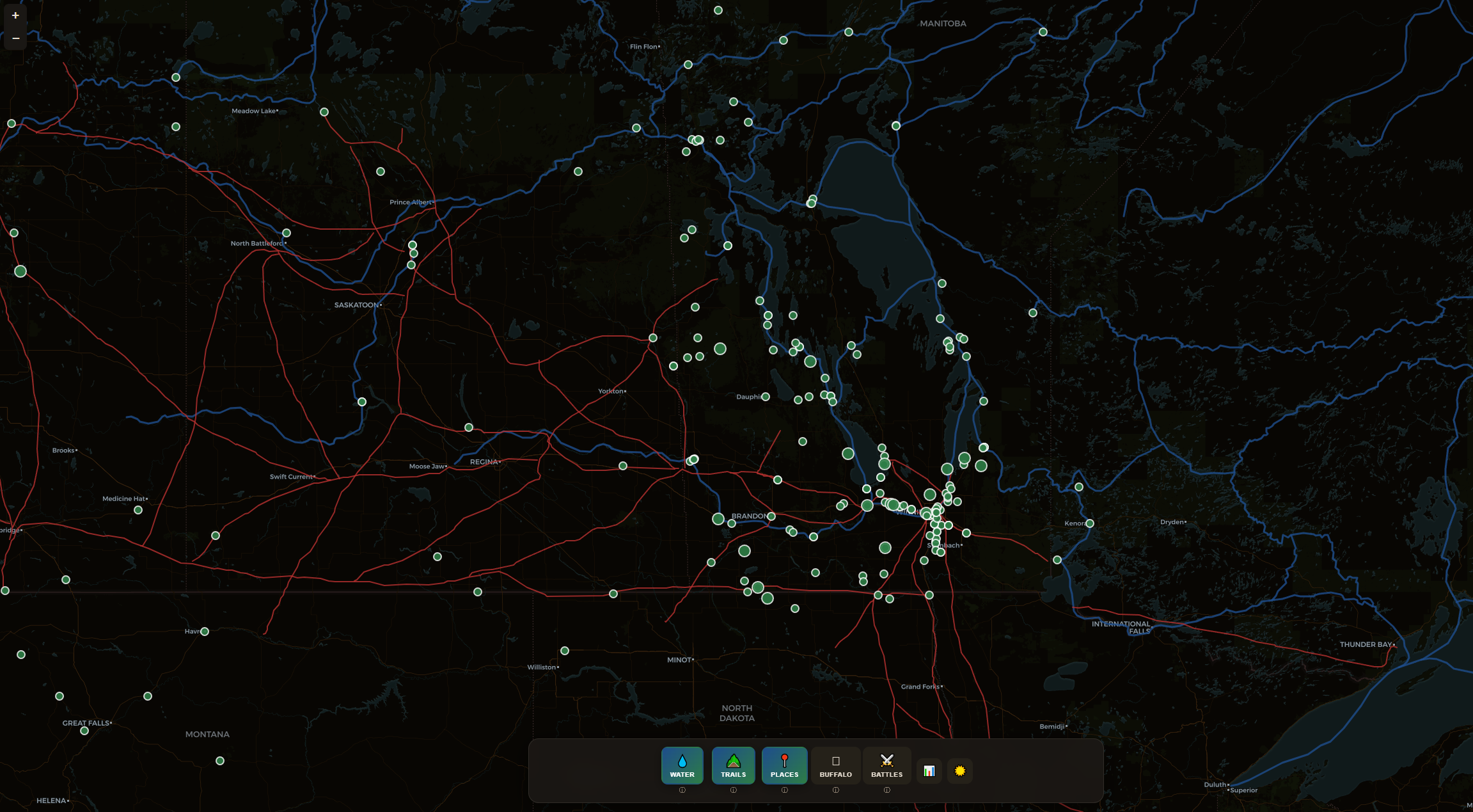
An interactive map of Métis territory with layers showing historic settlements, cart trails, waterways, buffalo migration patterns, and historical resource use. Built from scratch using historical maps I had to digitize myself. No research team, no precedent data.
D3.js
GeoJSON
Leaflet
West and Back Personal
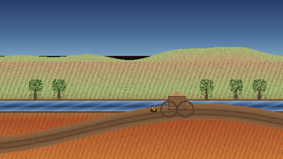
A narrative-driven historical simulation built on a custom TypeScript engine. Blends authentic 19th-century economic mechanics (Made Beaver) with branching storylines and handcrafted 32-color pixel art.
TypeScript
Canvas
Pixel Art
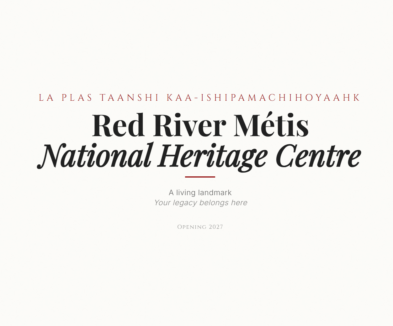
Website for the Red River Métis Nation Heritage Centre. Information about exhibitions, events, and Métis history. Content managed via Contentful CMS.
Next.js
Contentful
Three.js
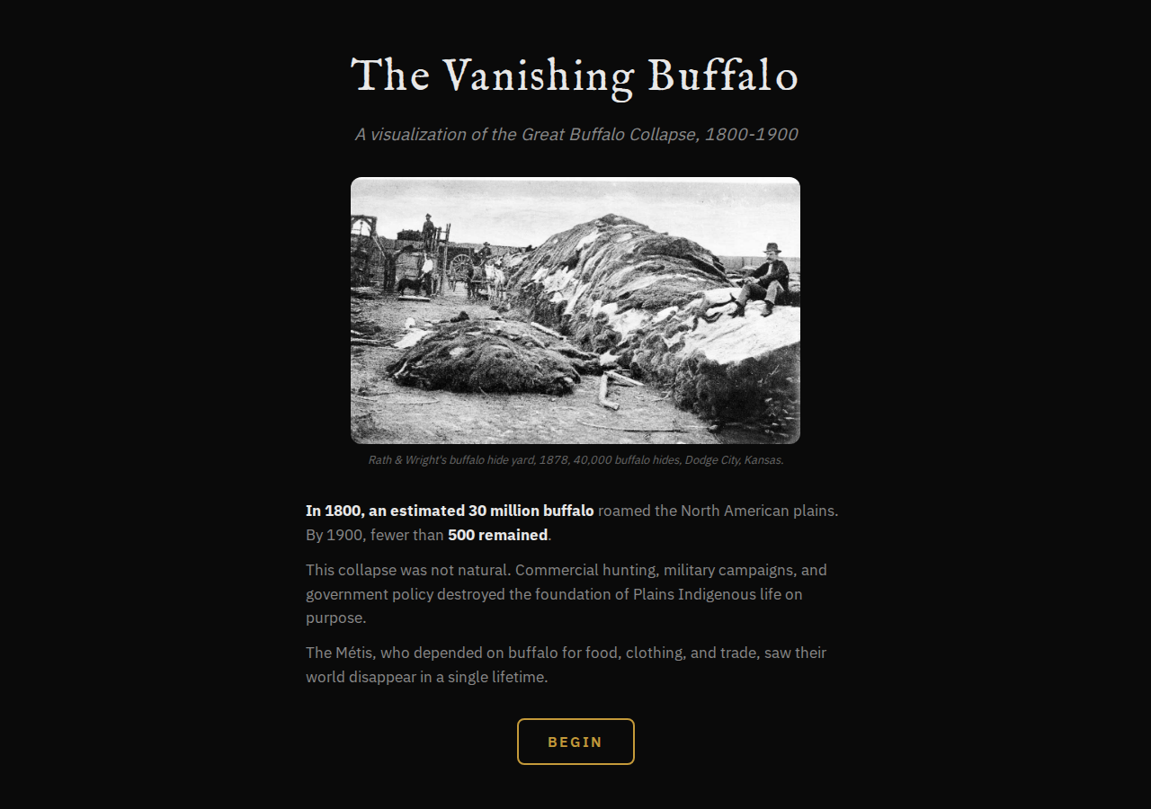
The plains buffalo went from 30 million to under 1,000 in a century. This data-proportional timeline illustrates that devastating decline toward near extinction, while highlighting the reasons behind the collapse.
D3.js
JavaScript
Data Viz
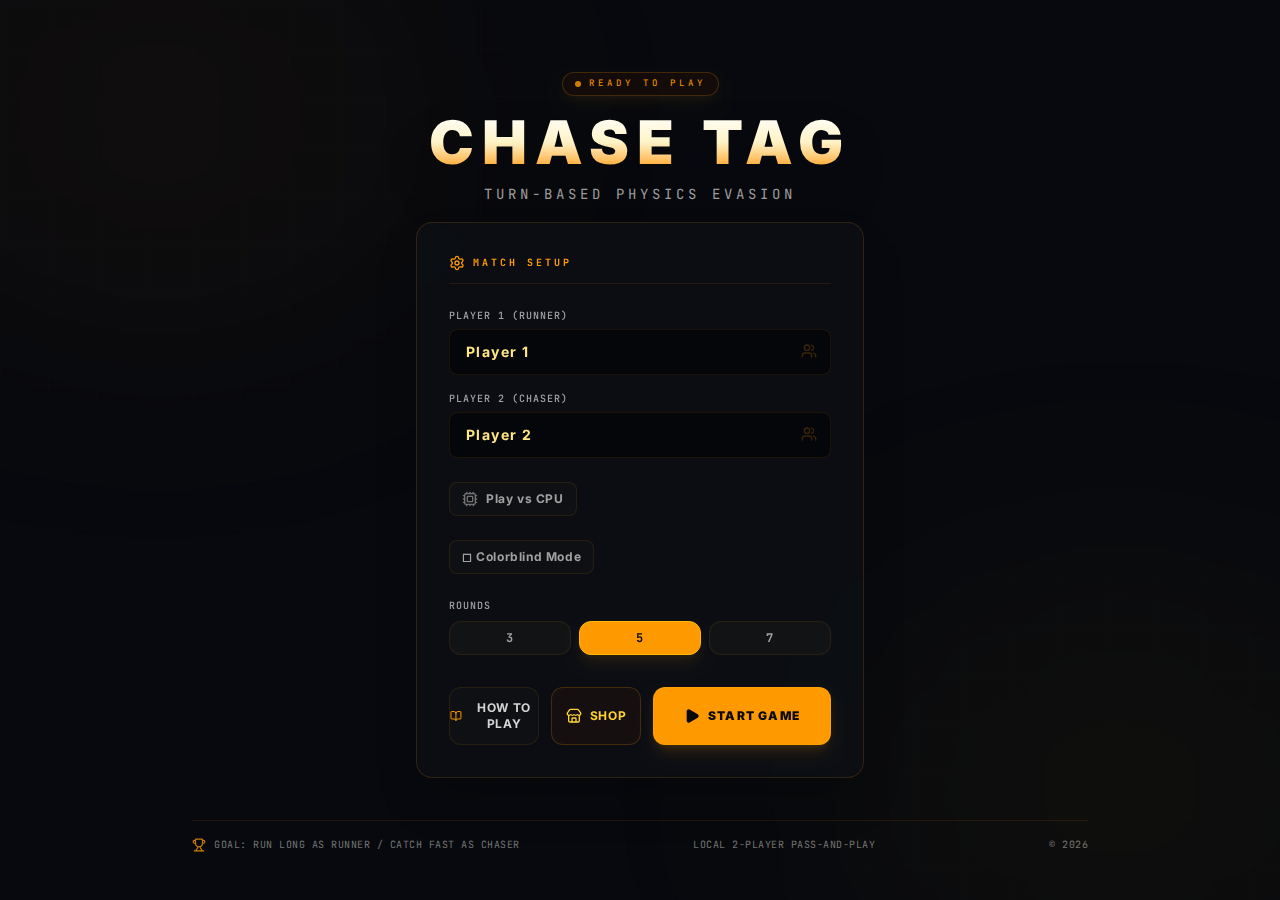
A turn-based mobile tag game -- one hides, one seeks. My first attempt at building a functional game that works across platforms. Coming to Google Play as our first published game.
TypeScript
Canvas
Mobile
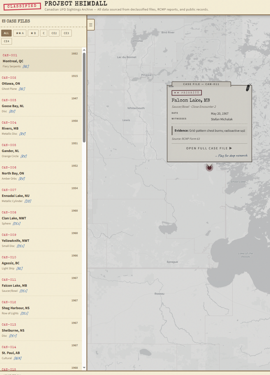
An interactive geospatial archive of 70 Canadian UFO sightings spanning from 1662 to the present. Built with Leaflet.js and a classified-document aesthetic -- manila folder tones, red "CLASSIFIED" stamp, typewriter fonts.
Leaflet.js
JavaScript
GeoJSON